nez d'injecteur DOP 150P 529-3870.
-
Prix
33,58 €
Offres spéciales
-
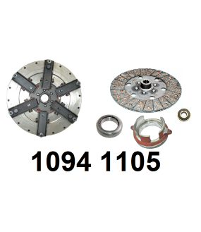
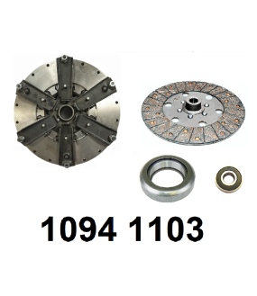
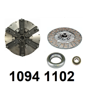
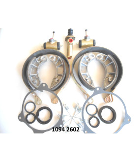
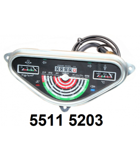
kit d'embrayage.Prix 576,05 € -10% Prix de base 640,06 €kit d'embrayage.Prix 499,60 € -10% Prix de base 555,11 €kit embrayage.Prix 488,03 € -10% Prix de base 542,26 €kit réparation freins (2 cotés).Prix 223,39 € -20% Prix de base 279,24 €tableau de bord.Prix 75,87 € -10% Prix de base 84,30 €